Digital WaterThe Digitalisation Journey ofUrban Climate Resilience:Case Studies on FloodManagement and ResilienceAuthorsMarina Batalini de Macedo, Federal University of Itajubá, Brazil;Jyoti Gautam, Netaji Subhas University of Technology, Delhi, India;Sheilla de Carvalho, Royal Haskoning DHV, Singapore;Pilar Conejos, Idrica and Universitat Politècnica de València, SpainDigital WaterThe Digitalisation Journey ofUrban Climate Resilience:Case Studies on FloodManagement and ResilienceAcknowledgementsWe would like to acknowledge Oliver Grievson for providing motivation and support whilewe were writing this paper. Also, we would like to acknowledge Mr Sham Chaudhari, SalesDirector, India/South-Asia at Xylem for sharing the case studies with us for the resilience.SummaryThis white paper focuses on presenting digitalisation as an important tool to help improveflood resilience in cities, to cope with the climate crisis. The aim is to connect the conceptof resilience to the wide number of digital tools that can be used in different parts of theresilience cycle, when dealing with floods. Examples are presented to show the applicabilityof the digital tools in real-life case studies.© 2024 International Water AssociationPublished by the International Water Association. All rights reserved. Requestsfor permission to reproduce or translate this material – whether for sale or noncommercial distribution – should be directed to IWA Media Office via the website(www. iwa-network.org).All reasonable precautions have been taken by the International WaterAssociation to verify the information contained in this publication. However,the published material is being distributed without warranty of any kind, eitherexpressed or implied. The responsibility for the interpretation and use of thematerial lies with the reader. In no event shall the International Water Associationbe liable for damages arising from its use.The Digitalisation Journey of Urban Climate Resilience: Case Studies on Flood Management and Resilience | 3ForewordIn an era when the pace of urbanisation is accelerated and the impacts of climate changeare intensified, our cities face unprecedented challenges in ensuring the resilience oftheir water systems. Uncertainty in weather patterns, especially with increased frequencyof flash flooding, poses a threat to human life and presents governments with the costlyburden of rehabilitation. Meanwhile, we are working against time and a pressing need forresources to achieve the UN Sustainable Development Goals by 2030. Despite progress insome areas, the exacerbation of existing challenges, such as population growth, and theadvance of new ones, such as cybersecurity breaches, add to the demands of meetingthis deadline. Against this backdrop, cities need to advance urban climate resilience to give them the abilityto withstand, adapt to, and recover from the adverse impacts of climate change while maintaining essentialfunctions and services.Digitalisation of the water sector offers a myriad of opportunities to enhance the resilience of urban watersystems. From real-time monitoring and predictive analytics to advanced modelling and decision support tools,digital technologies empower cities to anticipate, adapt, and respond to the impacts of climate change on theirwater infrastructure. Technological options are available and evolving fast. At the same time, realisation of theseopportunities requires concerted efforts from stakeholders across sectors and scales. It demands a paradigmshift in our approach to urban water management — one that embraces interdisciplinary collaboration,embraces data-driven decision-making, and prioritises the resilience of communities, particularly those mostvulnerable to the effects of climate change.Over the past five years, IWA has advanced its action on digitalisation, placing it at the forefront of our effortsto bridge the gap between research and practice. This action is helping shape the digital transformation journeyof the water sector. The IWA Digital Water Programme stands at the forefront of this transformative journey,catalysing innovation and fostering collaboration to address the pressing water challenges of the 21st century.In this time, IWA has produced numerous knowledge-sharing products to help practitioners, solutions providersand utilities address the challenges and growing pains of digitalisation. In particular, we have published tenwhite papers showcasing developments in the digital transformation journey of the water sector.We are pleased to add to the list this latest white paper on innovations in the vital area of urban climateresilience. This paper highlights the synergy between urban climate resilience and digital water solutions as anessential means for safeguarding the well-being of our communities and the sustainability of our cities.An important feature of IWA’s ability to work with and through its network is that, through our knowledgesharing products, we continue to highlight different perspectives, often casting light on the need to scalesolutions in the move to digital maturity. This latest paper adds a similar contribution, providing a broadercontext by showcasing perspectives from South America, Asia, Europe and Africa.IWA firmly believes that the generation and sharing of knowledge, along with the exchange of best practices,is critical to driving progress in the water sector. By fostering collaboration and promoting innovation, we cancollectively address the pressing water challenges of today and create a sustainable future for all. Through thiscommitment, IWA continues to empower professionals and communities to ensure access to clean, safe waterworldwide and to improve water management more broadly.Kalanithy VairavamoorthyExecutive Director of the International Water AssociationTable of ContentsIntroduction 6Digital tools on urban resilience cycle 82.1. Individual disaster response 92.2. Response / Relief 92.3. Recovery (Rehabilitation and reconstruction) 92.4. Mitigation 102.5. Preparedness 10Case studies on floods 113.1. Resilience building in a data-transition context; From data poor to data dense:Experience of Garid Project in Ghana by Bernard Makafui Agbelengor (Garid, Ghana) 113.2. Flood monitoring and warning system in urban areas based on Lorawan Communication Network:Case study for the City of Itajubá, Brazil by Benedito Cláudio da Silva (Federal University of Itajubá and Asthon,Brazil), Danilo Spadoti (Federal University of Itajubá and Asthon, Brazil), Caio Tácito Borges da Costa (Asthon,Brazil), Vitória Jacomelli Baratella (Asthon, Brazil) 133.3. An early warning system to prevent and manage river basin flooding. Application to the Ebro River Basin(Spain) by Antonio Moya (Idrica, Spain), Mario Carreras (Che, Spain), Esther Ruíz (Che, Spain), Ramón Lúquez(Che, Spain) 163.4. Urban flooding early warning system. Application to the Municipality Of Calpe (Spain) by Vicente Balanzá(Idrica, Spain), José Alberto Mut (Aguas De Calpe, Spain), Dola Gupta (DST Women Scientist, India) 183.5. A multi-sensor approach to precipitation measurement and nowcasting for flood resilience in Singaporeby Munsung Keem (H2i, Singapore), Gineesh Sukumaran (H2i, Singapore), Wei Kit Lee (H2i, Singapore),Ni Qing Puay (Pub, Singapore), Wing Ken Yau (Pub, Singapore), Sara Teh (Pub, Singapore), Tien Ser Tan (Pub,Singapore) 20Key lessons learnt 23Conclusions and recommendations 23References 2412345The Digitalisation Journey of Urban Climate Resilience: Case Studies on Flood Management and Resilience | 6The need for resilience has become a strategic decision-makingpriority globally to tackle the emerging and more frequentnatural and man-made challenges, such as rapid urbanisation,increasing population, climate change and other socio-politicalchallenges. In the case of extreme weather events, the impactson people and communities are growing increasingly severedue to the rising frequency and intensity of events like floodsand droughts, which are a consequence of climate change(Vermij, 2023).According to a report published by the United Nations (CRED &UNISDR, 2015), the majority (90%) of natural disasters recordedin the last 2 decades were climate-related.As per the international database (EM-DAT),which is the Emergency Events database,6457 weather-related disasters haveoccurred between 1995 and 2015. Floodscontribute to the maximum percentageof 43% among the natural disasters. Morerecently, we have seen other examplesof these disasters such as the floods thatoccurred in Pakistan in 2022 and affected athird of its territory; the floods in northeastBrazil which lasted more than two monthsbetween the end of 2021 and the beginningof 2022; the floods in Eastern Europe in2021, which reached Germany, Belgium, andthe Netherlands, among others. Floods inLibya in 2023 led to devastating loss of life with some 11,000confirmed dead and at least 10,000 missing. The latter partof 2023 had seen unprecedented rainfall and major floodevents with severe consequences to people and communities,infrastructure, and economies as well as natural environments.The new IPCC report AR6 projects a 1.5-fold increase in heavystorms (return period = 10 years) across the globe, even underscenarios of a more conservative rise in temperatures of 1.5°C(IPCC, 2021). Given that 55% of the world’s population lives inurban environments (UN DESA, 2019), there is an urgent needto strengthen the urban resilience of water, sanitation, andstormwater drainage infrastructure.There is a wide range of definitions and approaches toresilience, and it is important to have a clear understanding ofthe needs, perceptions, and priorities when choosing a methodor definition. Internationally, the most adopted definition forpublic policies is the one presented by the United NationsOffice for Disaster Risk Reduction (UNDRR) and used in theSendai Framework (UNDDR, 2015):More specific to the context of cities, Zhang and Li (2018) havesurveyed the terms ‘Urban Resilience and Urban Sustainability’,used in different applications in international studies, andsuggested the definitions:1. IntroductionResilience means the ability of a system,community or society exposed to hazards toresist, absorb, accommodate to and recoverfrom the effects of the hazard in a timelyand efficient manner, including through thepreservation and restoration of its essentialbasic structures and functions.The Digitalisation Journey of Urban Climate Resilience: Case Studies on Flood Management and Resilience | 7Using these definitions, we can understand urban resilienceto climate change as a city's ability to withstand the negativeimpacts of external climate changes and restore its previousstate within a suitable timeframe, ensuring the recovery ofecosystem services and human well-being. This ‘suitabletimeframe’ is different for each negative effect generated.For example, in the case of floods, the suitable period is theduration of the precipitation event and peak flow recession.Many approaches, techniques, and policies have beenpresented to increase cities’ resilience and reduce riskexposure. However, as stated by Martens and Carvalho (2023),“many organisations simply do not know where to starttheir climate resilience journey due to the complexity andmultiplicity of the topic”. Digital tools have been presented asa growing and promising approach to help actions to be takenat different stages of the resilience cycle and can be enablersto organisations to prepare themselves against the impacts ofclimate change (Martens & Carvalho, 2023).This white paper aims to present inspiringexperiences of how digital tools have helpedthe process of urban resilience to floods indifferent contexts. The authors hope thatthese experiences can promote and inspirenew success stories. The document presentsthe background to the problems of extremeflooding in the urban context and climatechange, in order to aid understanding ofthe main associated risks. Subsequently,the different steps of the resilience cyclein which digital tools can help optimise theprocess are presented. This is followed bycase studies related to the use of these toolsto build resilience to floods. Finally, the mainlessons learned from these experiences andrecommendations for future applicationsare presented.Urban resilience is the passive processof monitoring, facilitating, maintainingand recovering a virtual cycle betweenecosystem services and human wellbeingthrough concerted effort under externalinfluencing factors,” and “Urbansustainability is the active process ofsynergetic integration and co-evolutionbetween the subsystems making up a citywithout compromising the possibilitiesfor development of surrounding areas andcontributing by this means towards reducingthe harmful effects of development on thebiosphere.The Digitalisation Journey of Urban Climate Resilience: Case Studies on Flood Management and Resilience | 82. Digital tools on urbanresilience cycleThe actions involved in improving resilience to disasters areusually classified as short-, medium-, and long-term actions,which can also be divided into actions that take place beforethe disruptive event, that is, risk reduction measures, andafter the event, that is, recovery measures. These actionscan be perceived as a cycle in disaster management (Figure1), involving the stages of individual disaster response,response/relief, rehabilitation, reconstruction, mitigation,and preparedness (Davis & Alexander, 2015). In the context ofurban disasters related to floods and droughts, different typesof digital technologies and tools have been used at each stageof the resilience cycle, and these are presented in this section.Figure 1: Insertion of digital tools into different parts of the resilience cycle to mitigate the effects of the disaster.Abbreviations. RTM: Real-time Monitoring; RTC: Real-time control; VGI: Volunteered Geographic Information;WSN: Wireless Sensor Networks; UAV: Unmanned Aerial Vehicles.Individual Response• Communication of the disaster• Warning to the populationand Civil DefenseResponse• Communication of the disaster• Response measures to thepopulation• WSN, UAV and VGI to assessthe priority affected sites• UAV to support evacuationroutesRehabilitation• Data-driven techniquesenhancing flood insurance• VGI, UAV and flood modelling toidentify priority reconstruction sitesReconstructionMitigation• Create warning systems• VGI to collect additional data• RTM and RTC• Modelling and risk mapping• Digital twins to flexible operation offlood mitigation infrastructurePreparedness• (Early) warning systems• Nowcasting technologies• Modelling• RTM and RTC• VGI to improve earlywarning systemsDisasterThe Digitalisation Journey of Urban Climate Resilience: Case Studies on Flood Management and Resilience | 92.1. Individual disaster responseAt the individual disaster response stage, the actions andmeasures focus on an immediate response, aiming at anindividual’s security and safety, providing first aid, and securingessential supplies. In this sense, it is necessary that peoplehave access to information about the disaster, its location,scale, and with sufficient time to take actions. Therefore,digital tools are being used in this part of the resilience cycle toforecast, visualise, communicate, and alert the population andkey stakeholders about the disaster. Examples of use of digitaltools are:● Communicating flood alerts to the population throughmobile networks, social media, and traditional media(Feldman et al., 2016; Shrestha et al., 2021).● Cell-broadcast (CB) technology (Parsons & Hamilton, 2023):unlike SMS, which is a one-to-one channel, CB is a one-tomany technology. This means that one message can besent to millions of devices within a few seconds. CB worksby distributing content via specific cell sites based on asubscriber’s location. Unlike SMS, CB does not require aphone number to send a message. It therefore enableslocation-specific emergency alerts to be sent without theneed to register or track devices. As well as being moreprivate than SMS, visitors to the target area, includingfrom abroad, will also receive alerts, and even in their ownlanguage if the system is multi-language enabled.A big challenge remains on how to disseminate the informationto the most vulnerable groups (including economic), that maynot have access to digital technologies (Downer & Hamilton,2024).2.2. Response/reliefAt the response/relief stage, the interventions are of shortterm duration and are provided by more structured andinstitutional agencies, such as civil defence groups. Theseactions aim at search and rescue; provision of food, water,sanitation, and safe shelter; and delivery of medical, social,and economic support. During this stage, it is also necessary tohave a good communication system between the institutionalagencies and the population, so they can be advised/warnedabout the disaster, how to proceed after the disaster happens,and where to look for help.● Wireless Sensor Networks (WSN) and Unmanned AerialVehicles (UAV) systems have been used to improve theresponse and relief to flood disasters (Erdelj et al., 2017).Aiming at improving victims–civil defence communication,WSN coupled with UAV can be used to extend internetconnectivity, allowing the victims to use their own mobiledevices. Another example is the use of UAV to provide anoverhead view and help surface vehicles to find an optimalpath to rescue and provide support to the victims.● WSN can be integrated with crowdsourcing/crowd-sendingand Volunteered Geographic Information (VGI) platforms,allowing smartphone users to provide real-time informationabout the conditions of the affected area to civil defence,helping them to conduct rescue and support missions (Poser& Dransch, 2010). As examples, Waze and Twitter/X havebeen used as platforms to collect VGI information (Lowrie etal., 2022, Yuan et al., 2022).2.3. Recovery (rehabilitation andreconstruction)Recovery involves rehabilitation and reconstruction. Therehabilitation and reconstruction stages aim, respectively,at restoring the basic services/functions of the system, inthe short- and mid-term, and the full capacity of the system,also including preventive measures for future disasters, inthe mid- and long-term. Here is where the idea of ‘build backbetter’ should be strongly embedded, driving not only the fullrecovery/reconstruction of the system, but in a way better andmore resilient than it was in the first place. Digital tools thatsupport this process include the following:● Data-driven techniques to enhance insurance risk analysis, bymapping the flood risk and communicating to the population(Rumson & Hallet, 2019). For this, data collection techniquesand analytics, such as satellite-derived data, internet ofthings (IoT) sensors, cloud computing, and Big Data solutionsare used. This allows extending coverage of flood insurances,helping rehabilitation and reconstructing individual assets.● Flood damage estimation, including critical and recurrentsites, through VGI, UAV, and flood modelling, to identifywhere reconstruction is needed and where to take inpreventive measures for future disasters, designing andsizing of the measures, and efficient assessment (Poser &Dransch, 2010, Erdelj et al., 2017).The Digitalisation Journey of Urban Climate Resilience: Case Studies on Flood Management and Resilience | 102.4. MitigationThe resilience cycle also encompasses measures that should beenacted before potential disasters and focus on risk reduction.Mitigation measures must focus on risk assessment andprevention. At this stage, it is important to understand the risks,in terms of their processes and their different levels spatiallyand temporarily. After assessing and understanding the risk,structural and non-structural measures must be developed tohelp prevent the risk or reduce its impacts. Examples of digitaltools that are being used in this stage include the following:● VGI collected from social media, e.g. pictures and videosfrom flood events, and processed to obtain flood depths, tohelp calibrate and validate 2D flood models (Drews et al.,2023).● Real-time Monitoring and Control (RTM&C) systems(consisting of sensors, actuators, communication devices,and web server) aimed at flexibilisation and adjustment offlood mitigation infrastructure to manage real rainfall-runoffevents and conditions, e.g. artificial wetlands (Pang et al.,2023) and bioretention (Persuad et al., 2024).● Use of Digital Twins is a new approach that is emerging inflood resilience (Brasil et al., 2022) and aims at moreintegrated systems of flood modelling, RTM&C, and life-timeperformance evaluation of urban flood infrastructure.2.5. PreparednessAn important part of the resilience cycle is the preparedness,where action plans are developed to take place right beforethe disaster event, in order to reduce its impacts by ensuringthe population is better prepared and knows how to conductthe response measures needed. Ideally, preparedness shouldbe the first stage of resilience building. Humanitarians stronglyemphasise that preparedness is often overlooked even thoughit is the most cost-effective measure and saves many more livesthan do actions taken after a disaster.At this stage, it is important to develop contingency plans,warning systems, and evacuation systems, as well as othermeasures to consolidate preparations for further disasters.Examples of digital tools that are being used in this stageinclude the following:● Water-depth sensors in the river channels as part of Realtime Monitoring (RTM) systems and early-warning systems.Low-cost sensors have been developed to increase theapplicability of this solution in various contexts (Catsamas etal., 2023, Baratella et al., 2023).● Crowdsourcing platforms to collect VGI on channel waterdepths to update flood models in real-time, helping improveflood prediction and early flood warning (Degrossi et al.,2014).● Transformed geo-social media activity (obtained by Twitter/Xplatform) as a proxy for rainfall-runoff estimation and floodforecasting, in ungauged or poorly gauged catchments toimprove early flood warning (Restrepo-Estrada et al., 2018).● Improving real-time rainfall estimation (nowcasting), throughthe existing closed-circuit television (CCTV) network coupledwith convolutional neural network (CNN) models (Sukumaranet al., 2024) and radar X-band data (Keem et al., 2021).Figure 2: The Delta Works contribute to climate resilience by offering both short-term protection against extremeweather and long-term solutions for rising sea levels, ensuring that the Netherlands can thrive in a changing climate.The Digitalisation Journey of Urban Climate Resilience: Case Studies on Flood Management and Resilience | 113. Case studies on floods3.1. Resilience building in a datatransition context; from data poor todata dense: experience of a GARIDproject in GhanaBernard Makafui Agbelengor (GARID, Ghana)Company presenting the case studyThe case study is presented by the Greater Accra Resilient andIntegrated Development (GARID) Project, which is an initiativeof the government of Ghana, jointly with the Ministry of Worksand Housing; Ministry of Sanitation and Water Resources;and Ministry of Local Government, Decentralization and RuralDevelopment. Funding comes from the World Bank.IntroductionResponding to the need for flood management in Accra,the government of Ghana, with the help of World Bank, hasinitiated a flood mitigation and adaptation measure projectcalled the Greater Accra Resilient and Integrated Development(GARID) Project. The GARID Project is supporting the GreaterAccra region to adapt its drainage and flood risk managementand has also in collaboration with the MMDAs developed anongoing programme to gather, organise, and analyse flooddata and make the necessary engineering and non-engineeringinterventions.This case study focuses on building resilience in a datatransition context: from data poor to data dense. The aim wasto show how different data technological tools are used in theGARID Project to ensure resilience in the long run. Key areas ofthis case study included an overview of what GARID is and howit was developed.The GARID project uses different data-centric approaches,such as Google Earth, Kobo collect aerial imaging (UAV), LiDAR,Hydrologic Engineering Center River Analysis System (HECRAS) for flood modelling, and Geographic Information Systems(GIS). They have been used for risk, damage assessments,monitoring, mitigation, adaptation, and prediction in hydraulicand hydrologic flood simulations.Many studies lack specific references to data-driven built-assetresilience decisions and unambiguous consequences on floodand built-asset resilience enhancement. This implies that thereare more chances to contextualise data for flood resistancein the built environment. The study concluded that theconceptual map of the flood context, approaches, data types,and the data technology have improved resilience.ObjectivesThe objective of the GARID Project is to improve flood riskmanagement and solid waste management in the Odaw riverbasin of the Greater Accra Region and to improve access tobasic infrastructure and services in the targeted communitieswithin the basin. The overall goal of the project is to achieveclean, resilient, inclusive, and integrated development in theregion. The project has been scheduled into five differentcomponents:1. Climate Resilient Drainage and Flood Mitigation Measures;2. Solid Waste Management Capacity Improvements;3. Participatory Upgrading of Targeted Flood Prone LowIncome Communities and Local Government Support;4. Project Management;5. Contingent Emergency Response.The project was a result of the flood event that happened inAccra on Wednesday, 3rd of June 2015, now known as the‘June 3rd disaster’, and other recurring floods. This event wasconsidered a “black day” in Ghanaian history because heavyrainfall transformed into a terrible fire and flood disaster thatclaimed the lives of an estimated 154 people and left scoresmore with varied degrees of burns and injuries that left thempermanently disabled.The Digitalisation Journey of Urban Climate Resilience: Case Studies on Flood Management and Resilience | 12Intervention through digital toolsThe project began with severalfeasibility studies, with some dataacquired to guide the implementationof the project. Collecting and analysingmore data in relation to the baselinedata that were acquired during thefeasibility works relied on a numberof digital tools. These tools were opensource, but with the transition of theproject to the implementation phase,the project has acquired servers, and setup a data centre, that meet internationalstandards, which will be leveraged uponby the citizenry.Google Earth was used to locate andmap project sites and to measuredistance. Being able to locate the projectsites helped to show the general publicplaces that are flood hotspots and theinterventions to be undertaken. Storagewas also required for all the data that was being acquired, andsince the project was at its inception, Google Earth served asstorage for all the spatial data being gathered; thus, the projectspatial database was on this program. Although eventually thetool became very slow to open due to the load of data storedthere, it was our only sustainable hope at that time.Aerial imaging (by UAVs) was used to capture videos andimages of the affected project sites as well as to capture imagesof safe havens in the region. This gave the project coordinatingunit and implementing units a bird’s eye view of the Odaw river(Figure 3). The accumulation of silt and solid waste in the riverwas clearly shown. These videos and images gave a head startto deciding how to go about solving the problem of flooding inthe Odaw Basin.LiDAR was used to help in the engineering designs of theintended project interventions and to capture all the buildingfootprints in the Greater Accra Region. The measurementsof all the buildings were also captured. This was very usefulin determining compensation of project-affected persons.The building footprint data made it possible to generate amap showing all the buildings in each Assembly in the region.Further, maps were generated showing how many buildingshad encroached on the 50-metre buffer zone of the Odawchannel (Figure 4). KoboToolbox was very useful in the data collection processof the project. This was pinned to project sites on the GoogleEarth locations. Any data collected using Kobo could bedisplayed on Google Earth. This tool was used in collecting dataon all existing drainage in the basin catchment.Figure 3: Safe havens and flood prone areas of influence within the Odaw catchment.Figure 4: Maps constructed from LiDAR images containingbuildings that had encroached the 50-metre buffer zone of theOdaw channel.The Digitalisation Journey of Urban Climate Resilience: Case Studies on Flood Management and Resilience | 13HEC-RAS for Flood Modelling used the RAS Mapper to create a1D model of all the river systems in the region. Finding the keylocations of flood hotspots assisted the project coordinatingand implementing units in taking steps to lessen the impactof floods or to put adaptation plans in place to prevent futureflooding events of the same type.QGIS served as the GIS tool for digitising and conducting spatialmanipulations on the data gathered. Due to sustainabilityconcerns, this tool was the optimal choice for all governmentagencies. Occasionally, other tools like Arc GIS and GlobalMapper were used when the need arose. Global Mapper isused for manipulating raster data and it accepts a wide rangeof data set formats. The ArcGis Online platform was used inmapping out all gender based violence relief centres and usedfor periodic updates of the data. This was relied on mainlybecause of its dashboard functionality.Qfield was another data collection tool deployed in datacollection and field verification exercises. Its mother tool isQGIS. This tool helped in digitalising on field data and madeany spatial edits that were required on field data.Thus, Kobo was mainly used to collect attribute data andsome spatial data. Once the data was transmitted to the GISoperating tool and the digitisation was completed, the datawas migrated to the Qfield environment for field verification.ConclusionThe case study illustrates the use of digital tools for gaininga comprehensive understanding of the current context ofdata utilisation for flood resilience of built assets for societalsustainability from data poor to data dense. The data digitaltool has helped the project to: prepare a safe haven register,prepare principles and guidelines for safe havens, conduct safehavens distribution analysis, make the project team aware ofwhen each safe haven needs renovation or enhancement, andbe able to monitor all the safe havens and project constructionsites without being present on site.Technology’s impact on resilienceDigitalisation technology has improved the resilience of floodmodelling scenarios making it easy to predict river flows andrainfall levels combined with topographic data to generateflood risk information effectively. These tools have provideddata for the setting up of a flood warning system, a spatialasset management platform, and flood models for the Odawbasin area. These are just but a few of the contributions of suchdigital tools for resilience building.3.2. Flood monitoring and warningsystem in urban areas based on aLong Range Wide Area Network: casestudy for the city of Itajubá, BrazilBenedito Cláudio da Silva (Federal University of Itajubáand ASTHON, Brazil), Danilo Spadoti (Federal University ofItajubá and ASTHON, Brazil), Caio Tácito Borges da Costa(ASTHON, Brazil), Vitória Jacomelli Baratella (ASTHON, Brazil)Company providing the case studyThe case study began with research developed at the FederalUniversity of Itajubá (UNIFEI), which resulted in the creationof the start-up company ASTHON Tecnologia Ltda., responsiblefor this case study. The solution presented is a partnershipbetween UNIFEI, ASTHON, and the civil defence of themunicipality of Itajubá.IntroductionThe growth of Brazilian cities without proper planning of thedrainage system, combined with increasingly intense andfrequent extreme meteorological events, has led to increasingand high economic and human life losses, annually reachingbillions of dollars and hundreds of deaths.Among the measures to mitigate the effects of extreme events,hydrological monitoring and the issuing of alerts to affectedcommunities stand out. Although the national telemetricmonitoring network has been expanded in recent years, mainlyafter the creation of the National Center for Monitoring andAlerting of Natural Disasters (Centro de Monitoramento eAlerta de Desastres Naturais - CEMADEN) in 2011, the numberof rain and river level measurement stations is still very small,falling short of meeting the needs of urban areas. In additionto the insufficient number of stations, traditional monitoringsolutions with transmission, via satellite and cellular networks,are expensive for municipalities and unsuitable for installationin urban areas, due to the infrastructure and space theyrequire. Furthermore, simply installing the equipment andtransmitting the data also does not serve municipal civildefence organisations, as they do not have specialised teamsto interpret the data and maintain the system. There arerecurring cases of cities with systems that no longer operatedue to a lack of specialised professionals to operate the system.Therefore, the challenge addressed in this case study was todevelop a monitoring and alert system for urban areas basedon compact measuring stations, with low construction cost,minimum energy consumption, simple maintenance and thatcommunicates measured data to the user in an objectivemanner and in accessible language.The Digitalisation Journey of Urban Climate Resilience: Case Studies on Flood Management and Resilience | 14The city of Itajubá is located in the south of the State ofMinas Gerais, Southeast region of Brazil. The Sapucaí Riveris the main watercourse that crosses the urban area of thecity and has a long history of major floods. In recent years,flash floods of tributary streams of the Sapucaí River withinthe urban area have become more frequent. Intense, shortterm rains cause riverbanks to overflow and streets to floodin several neighbourhoods. The mountainous and complexterrain requires a high density of monitoring stations, so thatthe full spatial variability of rainfall is captured. Furthermore,the response time of the basins is short, requiring telemetrymeasurements at very short intervals.ObjectivesThe main objective was to develop a telemetric hydrologicalmonitoring system using a Long Range Wide Area Network(LoRaWAN) (Joiner et al., 2023) to monitor, predict, and alertextreme hydrological events in the urban area of Itajubá.The proposed system will:● Monitor basins of different spatial scales, from areas smallerthan 1 km2 to around 1000km2;● Monitor events with different temporal scales, with temporaldiscretisation starting at 1 minute;● Create a communication network with LoRaWAN protocol tocover all monitoring points;● Develop an electronic module for collecting and transmittingdata via the LoRaWAN network;● Dimension monitoring stations at the lowest cost and mostcompactly possible;● Develop a web platform to make data available and issuereal-time alerts for municipal civil defence, with clear andobjective information.ab cFigure 5: (a) Map with part of the monitoring points in Itajubá, highlighting the monitoring station;(b) and (c) Monitored level and rainfall events, respectively.The Digitalisation Journey of Urban Climate Resilience: Case Studies on Flood Management and Resilience | 15Intervention through the digital toolsThe main digital tool used in this case study was theLoRaWAN communication system. The current low cost of itsimplementation motivated and enabled the development ofall other components of the system. A network of LoRaWANreceivers (gateways) was designed for the study area to receivemeasurements from all installed rain and water level sensors.The receivers are connected to the Internet and the data isstored on a cloud server and sent for users to view.The main digital component developed by ASTHON was thedata reception and transmission module via LoRaWAN. Entirelydeveloped by the company and called MARLIN, this moduleconsists of a digital circuit board where sensors are connected,and data is received and sent to LoRaWAN receivers. Extremelycompact and with low energy consumption, it requires a smallbattery whose charge can last for months, without needinga solar panel for recharging. The sensors used are preferablynationally manufactured and low cost.To complete the system with digital tools, a web platform wasdeveloped to visualise data and issue alerts. Data visualisationis graphical and uses colour scales, with indication of alertthresholds (Normal, Attention, Emergency). It is possibleto set the viewing period and access numerical data as well.The interface’s appearance is simple and highlights the mostimportant information, in order to facilitate decision-making incritical situations. Figure 5 shows some images of the system.ConclusionThe system is currently in the final phase of implementation,but the preliminary results obtained indicate that it meetsthe proposed objectives. The biggest difficulties in theimplementation phase are linked to identifying the locationsfor installing the stations, both in terms of the most suitablehydrological conditions and the safety of the equipment.Throughout the current rainy period, October 2023 to March2024, the system will be tested in different situations thatwill contribute to its improvement. From this first period ofmeasured data, forecast models can be developed.The entire development of the system has been based onseveral years of cooperation between team members andmunicipal civil defence teams. This experience made it possibleto identify the municipality’s deficiencies and needs in relationto the occurrence of extreme hydrological events. This way,it was possible to build a system tailored to these needs.However, it is a tool that requires continuous improvements,the success of which depends heavily on the collaboration andtrust of civil defence teams and other agents involved. Listeningto, and incorporating the experience of people who work onthe front lines of preventing and combating extreme events,is equally as important as using the best technology available.Technology’s impact on resilienceThe monitoring and alert system proposed in this case studywill improve the city’s resilience because it allows it to deal withextreme events more assertively. Anticipating the occurrenceof a flash flood within minutes can save lives and reduce muchmaterial and economic damage. Furthermore, monitoringexpands knowledge about the hydrological behaviour ofbasins, making it possible to plan short-, medium-, and longterm measures more effectively, increasing the water securityof populations.The Digitalisation Journey of Urban Climate Resilience: Case Studies on Flood Management and Resilience | 163.3. An Early Warning System toPrevent and Manage River BasinFlooding. Application to the EbroRiver Basin (Spain)Antonio Moya (IDRICA, Spain), Mario Carreras (CHE, Spain),Esther Ruíz (CHE, Spain), Ramón Lúquez (CHE, Spain)Company presenting the case studyThis case study is presented by Idrica in collaboration withConfederación Hidrográfica del Ebro (CHE). Idrica is a companyspecialising in the digital transformation of the water industry;in partnership with Xylem, Idrica leads the development ofXylem Vue powered by GoAigua. Confederación Hidrógraficadel Ebro is the river basin authority that manages, regulates,and maintains the water and irrigation of the Ebro River basin(northeastern Spain).IntroductionThe Ebro River is 9,309 km and flows through the north-eastof the Iberian Peninsula. The Ebro basin covers a surface areaof around 85,000 km2 and 347 main rivers. It gathers most ofits waters from the north of Spain (mainly from the Pyreneesand pre-Pyrenees), and it is probably the most important riverbasin in Spain in terms of the water resources it provides.The river flows through territories characterised by the threedifferent types of climates: Atlantic, Mediterranean, and atransition area with a great range of evapotranspiration andprecipitation rates. In every season, the combination of thesegeomorphological and climatological factors and climatechange cause heavy flood events of different types: river,pluvial and flash floods.The Ebro basin water authority is in charge of implementing theEuropean Floods Directive (2007/60/EC). In this framework, itis necessary to develop a Flood Risk Management Plan coveringmeasures, such as urban development, territorial planning,the natural environment, forest management, insurance,hydrology, and hydraulics. The Early Warning System (EWS),referred to as ‘VIGILAEbro’ in the water authority’s softwareinfrastructure, is a holistic software system to help in most ofthem by applying high innovative technologies.ObjectivesThe case study presents two main aims:● Reduce flood damage;● Provide early warning to civil protection and otherstakeholders for disaster management.To fulfil these two main objectives, some specific tasks wereneeded, such as providing hydrologic and hydraulic probabilisticmodelling, building a tool to provide recommendations ondams’ manoeuvres minimising risks and damages, and finallyproviding a tool to disseminate warnings to each stakeholder,such as other authorities and the general public.Intervention through the digital toolsThis case study is supported by the EWS tool , which is part ofthe solutions provided by Xylem Vue powered by GoAigua.The tool computes, analyses, and provides warnings andrecommendations based on a big amount of data. So, a widevariety of technologies have been developed and combined:● Cloud computing and Big Data analytics supportingprobabilistic modelling in real time, both hydraulic andhydrologic.● Geo-statistics and machine learning techniques, to improveinput data quality as rainfall estimates or weather forecasts(see figure 6).● AI inference engine and heuristics, to provide basin-widemanagement recommendations.EWS runs in 10-minutes cycles in order to provide earlywarnings as soon as possible. To achieve the goals, eachcycle is composed of: (1) acquisition of information providedby hydrological and meteorological sensors, rainfall radar,and weather forecasting models; (2) weather data correctionFigure 6: VIGILAEbro rainfall maps. Use of geo-statistical and machine learning correction algorithms.The Digitalisation Journey of Urban Climate Resilience: Case Studies on Flood Management and Resilience | 17algorithms; (3) hydrological and hydrodynamic simulation(see figure 7, left); (4) computation of current and forecastedflows for different return periods to obtain flood maps (areturn period is the estimated average time between eventsand represents the estimated likelihood of a flood eventto occur; the longer return periods are the least likely and,generally, the most dangerous; see figure 7, right); (5) run theinference engine and feedback with modelling to computerecommendations on dams management to minimise risks anddamage; and (6) warnings and alerts dissemination to mobilephones and websites filtered by user needs, such as locationand role in the disaster management.ConclusionThe deployment of the EWS in a system as large as theEbro River basin, and its adaptation to current Spanish andEuropean legislation on water and floods, has taken threeyears. Currently, the system is operating at full capacity, someof its capabilities are in the testing phase with the aim ofcollecting feedback from stakeholders and the general public,which represents a valuable input to improve and ensure theaccuracy and reliability of the system’s operation.In terms of technology, the EWS software system combinesdifferent technological approaches to provide early warningsduring floods in a variety of flood scenarios, involving differentinformation and the application of a specific methodology foreach case.Benefits are quite significant because it has been shown that:● EWS has enough flexibility to adapt to different types offloods events (from localised heavy rainfall to rivers floodsand with or without snowmelt);● It provides high accurate flows and levels forecasts by usingprobabilistic approaches;● It adapts to the information required by each stakeholderin terms of location and technical knowledge needed (fromtechnicians to the general public);● It provides very early warning, usually days or hours beforethe event happens.The next steps of EWS are focused on providing moremachine learning algorithms and geo-statistical computationcapabilities in order to make the system useful for droughtevents. Focused on this, the platform must ingest climatechange scenarios models, be able to compute future waterresources volumes in different what-if scenarios, and, finally,build new dashboards to help decision-making.Technology’s impact on resilienceIn terms of resilience, EWS use in the Ebro River basin waterauthority provides several improvements for all the peopleinvolved in a flood event. For the Ebro River water authority,the most significant benefit is the better understanding ofthe current and forecasted hydrological status of the basin. Itallows the improvement of dams’ management which providesimportant damage reduction in terms of economic costs andaffected population. Also, after each flood event managed byEWS, strengths and weaknesses of the protocols, organisations,and communications and software systems involved arehighlighted. These conclusions are highly relevant for planningof future efforts and investments.All the actors involved in a disaster management such as civilprotection, police, or municipalities, can know in advance theaffected infrastructures, such as schools, bridges, commercialbuildings, which allows the earlier activation of the disastermanagement protocols focusing on affected elements filteredby population and infrastructures costs. In terms of people,the software system provides a comprehensive and easy-touse user interface updated in real time. The aim is to warnof the real risks and improve risk perception (refer figure 8).This is achieved by focusing only on the user location usingsemaphoric widgets.Figure 7: Probabilistic flow forecast (left) and flood maps byreturn period (right).Figure 8: Alerts and warning dissemination for public.The Digitalisation Journey of Urban Climate Resilience: Case Studies on Flood Management and Resilience | 183.4. Urban Flooding Early WarningSystem: Application to theMunicipality of Calpe (Spain)Vicente Balanzá (IDRICA, Spain), José Alberto Mut (Aguasde Calpe, Spain), Dola Gupta (DST Women Scientist, India)Company presenting the case studyThis case study is presented by Idrica in collaboration withAguas de Calpe. Idrica is a company specialising in the digitaltransformation of the water industry, in partnership withXylem, Idrica leads the development of Xylem Vue, poweredby GoAigua. Aguas de Calpe is the company that manages theentire water cycle in the municipality of Calpe.IntroductionThe municipality of Calpe, located on the coast of Alicante,Spain, has a total of 24,000 inhabitants. It is a touristic area, soit experiences a significant seasonal fluctuation of population,reaching a 600% increase in the number of inhabitants insummer.The urban development of Calpe occurred very quickly inthe 1960s. Therefore, several watercourses’ floodplains wereoccupied, and runoff evacuation was not adequately planned.Consequently, the municipality suffers from flooding problemsin urban areas and water pollution issues in sensitive areas,such as Las Salinas (wetland of great environmental value) orthe touristic beaches.In this region, flash floods are frequent due to an extremerainfall regime and orography, where mountains are closeto the coast. In addition, this extreme regime has beenaccentuated in recent years because of climate change. Forexample, in September 2022, it rained more than 140 mm in1 hour with tragic consequences as a policeman died whileparticipating in rescue work.The sewer network of Calpe is a combined system formed by75 km of pipelines, 17 pumping stations, and two wastewatertreatment plants. Several watercourses, usually dry exceptduring heavy rainfalls, cross urban areas.ObjectivesThe municipality of Calpe aims to have a system that improvesthe future management of urban flooding events and floodalleviation by a digital tool, in order to:● Reduce/mitigate the impact of flooding:i) Predicting urban flooding events, determining inadvance affected areas, and water levels and theirtemporal evolution. Alarms are triggered to anticipatemitigation measures. This prediction is based onthe integration of rainfall prediction models feedinghydrological–hydraulic models.ii) Simulating rainfall scenarios (what if) with real-timenetwork information in order to adapt emergencyactions.● Minimise the impact of overflows from the combined sewersystem to water body receptors such as wetlands or beachesduring storm events. Overflows occur when the capacity ofthe network is exceeded, so it alleviates the environmentcausing pollution issues. Overflow predictions allow themunicipality to take mitigation measures in advance.Intervention through the digital toolsThis case study is supported by the tool Real Time - What IfScenarios for Wastewater, which is part of Xylem Vue Valuepowered by GoAigua.The solution combines the precipitation forecast withhydrological and 1D-2D hydraulic models in order to predictthe areas that could be affected by flooding in the next 24–48hours. The solution has two main functionalities, depending onthe data availability:● Early Warning Prediction System;● Real-Time Early Warning System.The first of these functionalities is being implemented inthe municipality of Calpe and provides predictions of urbanflooding and flood alleviation for the next 24–48 hours, basedon the rainfall prediction (provided by AEMET-weather SpanishAgency) and the results of simulations of the hydraulic model.It is, therefore, required to have a calibrated mathematicalmodel of the sewerage network and urban surface runoff inrainfall events.The tool provides alarms based on estimated water levels orflow rates at several hotspots defined and configured by theuser. Estimations and alarms are shown in a map (Figure 9) aswell as in specific graphs for representing the evolution of avariable over the time. In addition, all alarms are shown in atable format (Figure 10).Real-time sensors are not strictly necessary for thisfunctionality, although its consideration will improve the qualityof the predictions. In this sense, it is recommended to havelevel sensors at least at road underpasses and other vulnerableareas where a large volume of water can accumulate.On the other hand, the Real-Time Early Warning Systemfunctionality, not implemented in this case study yet, is basedprimarily on real-time sensor data for both sewer levels andrainfall. In this way, the uncertainty associated with weatherforecasting is eliminated. However, the predictions made areshorter term (less than 1 hour). The system provides alerts ofexpected time to flood events, such as manhole overflows orspillways. This estimate is obtained from the mathematicalmodel based on the current water level inside the sewer pipeand the current rainfall intensity, assuming that this intensity ismaintained over time. The data is updated with the frequencyof the sensor data.The Digitalisation Journey of Urban Climate Resilience: Case Studies on Flood Management and Resilience | 19ConclusionThe main limitations of the capabilities of the tool in the casestudy of Calpe are:● Accuracy of the rainfall prediction and hydrological-hydraulicmodels;● Limited possibilities of operation in the current sewernetwork.In order to improve the rainfall prediction, future developmentscould use different sources and probabilistic models to considerseveral flooding scenarios. In addition, historical and real-timedata captured by the sensors could be used to automaticallymodify the parameters of the hydrological-hydraulic models toimprove its accuracy.Based on the capabilities of the present tool, the municipalityof Calpe will be able in the future to optimise the performanceof the sewer network installing electromechanics equipmentcontrolled in real-time.Technology’s impact on resilienceThe use of this digital solution will bring in the future a lot ofbenefits for urban flooding management in the municipality ofCalpe, because:● It will be able to provide prediction of the sewer systemperformance during rainfall events, determining the potentialareas affected, water levels and overflows.● It will anticipate decision-making and early activation ofaction protocols.● The algorithm and information management carried out bythe application will be able to improve the decision-makingprocess in the definition of coordinated plans or during theirdevelopment.● The system will be more resilient as it can reduce ormitigate negative impacts of urban flooding. In addition,the information captured during every event will be used toimprove future predictions and protocols.Figure 9: Expected rainfall, water levels and alarms map.Figure 10: Estimated water levels above ground level and alarms tableThe Digitalisation Journey of Urban Climate Resilience: Case Studies on Flood Management and Resilience | 203.5. A Multi-Sensor Approach toPrecipitation Measurement andNowcasting for Flood Resilience inSingaporeMunsung Keem (H2i, Singapore), Gineesh Sukumaran (H2i,Singapore), Wei Kit Lee (H2i, Singapore), Ni Qing Puay(PUB, Singapore), Wing Ken Yau (PUB, Singapore), SaraTeh (PUB, Singapore), Tien Ser Tan (PUB, Singapore)Company presenting the case studyThis case study is presented by Hydroinformatics Institute(H2i) in collaboration with PUB, Singapore’s national wateragency. H2i is an organisation at the forefront of applying datascience and artificial intelligence to water management andenvironmental challenges. With a mission to develop impactfulsolutions, the institute leverages over 9 years of expertisein water management in partnership with PUB and otherstakeholders. PUB is a statutory board under the Ministry ofSustainability and the Environment in Singapore, and managesSingapore’s water supply, water catchment, and used waterin an integrated way. PUB leads and coordinates whole-ofgovernment efforts to protect Singapore from the threat ofrising seas and the holistic management of inland and coastalflood risks.IntroductionIn recent years, the world has witnessed a surge in extremeweather events, with floods posing a significant threat tocommunities and infrastructure. Monitoring and predictingrainfall at high spatiotemporal resolutions in real time is criticalto minimising damage during times of flooding, enabling anaccurate inundation prediction to allow flooding-defenceresources and evacuation efforts to be deployed efficiently. Thisreduces the risk to the public and infrastructure by providingearly warnings of flash floods and/or flood-related informationto stakeholders to take more effective flood mitigation andprevention measures.It is, however, challenging to accurately measure and predictextreme precipitation at the desired resolutions due to theirhighly variable characteristics in space and time that typicalground rainfall stations (e.g., rain gauges) cannot capture dueto their sparsity. In this case study, we (the HydroinformaticsInstitute (H2i) and PUB) demonstrated our efforts in tacklingthis challenge through digital innovations to bolster floodresilience, especially in urban areas: weather radar-basedrainfall estimation and nowcasting systems, and closedcircuit television (CCTV)-based rainfall monitoring system.By integrating radar and CCTV technology, the institute aimsto enhance work done in precipitation measurement andforecasting.ObjectivesThe primary objectives of this case study include:● Enhancing the accuracy and efficiency of precipitationmeasurement;● Improving short-term rainfall forecasting through advancednowcasting techniques;● Improve the data quality and quantity for rainfall forecastingand evaluation.Figure 11: Example of the web interface.The Digitalisation Journey of Urban Climate Resilience: Case Studies on Flood Management and Resilience | 21Intervention through digital tools(i) Radar-based rainfall estimation and nowcasting systemsH2i, in collaboration with PUB, has been developingcomprehensive and advanced methods to monitor and predictrainfall using cost-effective and compact X-band weather radars(six in total), which are suitable for complicated urban settings.Since radar does not directly measure rainfall, but returnssignals from targets in the atmosphere, the accuracy ofradar rainfall estimation is highly affected by various sourcesof uncertainty, such as non-precipitation targets, beamblockage, and signal attenuation. Our system consists ofmultiple algorithms, each of which mitigates each uncertaintysource taking advantage of physical relationships amongdual-polarimetric radar variables and machine/deep learningtechnologies. The system developed shows outstandingperformance: for example, it shows 91.1% accuracy on averageat the ground level in removing non-precipitation radar signals;and the attenuation correction algorithm decreases rainfallestimation errors by 35% on average compared to thosederived from the typical rainfall-reflectivity relationship. Themonitoring system seamlessly merges multi-radar rainfallestimates into a single comprehensive rainfall map every 2minutes at 100-metre spatial resolution.Due to the short flood response time in urban areas (~30min), the radar-based nowcast model is required to producenationwide rainfall forecasts for up to the next 90 minutesevery 2 minutes. Based on the rainfall maps generated by themonitoring system, the nowcasting model estimates spatiallydistributed advection vectors of a storm and captures thetemporal evolution of rain intensities at a pixel level whiletracking the storm movement. The model considers thespatial-scale dependency of rainfall predictability. In addition,its adaptive parameter estimation scheme allows us toconsider the precipitation characteristics at the moment of theforecast. The real-time nowcast model achieved approximately70% probability of detection at the 30-minute lead time at a2-minute resolution for the past year. The nowcast model alsohas machine learning functionality. The forecast accuracy isexpected to improve over time as more data is collected andthe machine learning model is retrained.All information produced by the system is accessible andvisualised in real-time via a web interface, providing earlywarnings of heavy rainfall, if any, for flood-prone areas andhotspots defined by users. With this system, which gives amore localised forecast, PUB can pinpoint with higher accuracythe specific areas that are likely to experience heavy rainfall.This gives sufficient time for PUB to travel to locations withhigh flood risks in anticipation of any potential floods, keepingthe public out of harm’s way.Figure 12: Demonstration of the CCTV-based rainfall monitoring system.The Digitalisation Journey of Urban Climate Resilience: Case Studies on Flood Management and Resilience | 22(ii) Closed-circuit television-based rainfall monitoring systemMany cities operate their own closed-circuit television (CCTV)cameras, mainly for surveillance purposes. In Singapore,such CCTVs are also used by PUB to remotely monitor theroad conditions at flood-prone areas and hotspots. This factmotivated us to explore solutions that re-purpose the existingoptical sensors network at the ground (i.e. CCTVs) into newsources of rain rate measurements since (1) they can capturerain images at ground level; (2) the records are streamed andaccessible in real time without additional cost; (3) the densityof the cameras is usually much higher than rain gauges andmore so in urban areas.Due to the low resolution of most CCTV cameras (640 × 480pixels), we proved the feasibility of the technology in 2020by classifying rainfall status into five categories: no-rain, lightrain, medium rain, heavy rain, and extreme rain based on deeplearning technologies, achieving the probability of rainfalldetection greater than 82%. Following the results from thefeasibility study, the project has been scaled up, providing anoperational CCTV-based rainfall estimation system using 150cameras covering the whole of Singapore. The system hasincorporated an active learning framework to automate thedata labelling and classification of rainfall from all these CCTVcameras by using computer vision and deep learning. Thisallows us to reduce reliance on manual annotation as well as toincrease the quality and quantity of data. Through the system,the data annotation pipeline, model drift detection, andautomated and continuous model retraining are streamlined,contributing to the overall efficiency of the machine learningprocess.ConclusionReal-time rainfall data at high spatio-temporal resolutions arefundamental to the flood-related decision-making processes(i.e. prediction, operation, and evacuation). In this paper,we provided details of two technologies using weatherradars and CCTV networks. All systems are built on the cloudand modularised for conveniently scaling up and algorithmparameter adjustments with the functionality of continuousaccuracy monitoring and model retraining. For any area ofinterest, the systems can be efficiently deployed and optimizedunder given weather and device characteristics. As climatechallenges persist, innovative approaches like these are crucialfor developing adaptive solutions and building a more resilientfuture.Technology’s impact on resilienceThe technologies described in this case study have contributedto improvements in flood resilience. Weather radars coupledwith a nowcasting model and CCTV data can offer animproved understanding of precipitation patterns, enablingbetter forecasting and real-time monitoring. The activelearning system reduces manual effort, streamlining the dataprocessing pipeline and improving overall efficiency. Moreover,radar-based deep learning nowcasting can enhance short-termrainfall forecasting accuracy, enabling better preparedness andresponse to impending flood events.This case study contributes to a comprehensive climateresilience strategy, leveraging multi-sensor integration andadvanced digital tools. As climate challenges persist, innovativeapproaches like these are crucial for developing adaptivesolutions and building a more resilient future.AcknowledgmentsThe CCTV-based rainfall monitoring operational systemwas developed under the project “Demonstration Projecton Improving Rainfall Observation Using Street Level CCTVCameras in Singapore”, supported by the National ResearchFoundation (NRF), Singapore, and PUB under its Living Lab(Water) scheme.The Digitalisation Journey of Urban Climate Resilience: Case Studies on Flood Management and Resilience | 23The critical point we aimed to bring across is that digitalisationand digital tools have a key role to play in building more robust,resilient, and sustainable systems and cities. This is evidencedby the many ongoing applications in this field and case studies,of which only a few were highlighted here, where digital toolshelp to improve data management; enhance our knowledgeand awareness of cities and related systems; introduce smarterand more efficient ways to pre-empt and predict possiblescenarios; create more visibility and transparency on how toaddress these and how to prioritise efforts, resources and soon. The key lessons from this are summarised below:1. Digitalisation and digital tools in the context of climateresilience are innovative, yet the novelty comes in theirapplication in real practical problems and in utilities.Additionally, more research and development needs to bedone to refine and advance these innovations. Therefore,the question should not be “should we” but rather “howshould we?” adopt digital tools in this space.2. Digital innovations are for all, irrespective of geographies,granted that there are differences in readiness hencethere should be tailored approaches to adoption. A holisticapproach is key to reaping the benefits and ensuringadoption at scale, but one can start with the basics: data andinformation management.3. The importance of data and a data-driven approachshould be further underscored and certainly provides a keyfoundational pillar to the adoption of digital tools.4. There are many examples to draw from across the entireresilience cycle and the ongoing work and innovations arenothing short of astounding. The focus should therefore beon sharing these insights and best practices as well as crosscollaboration to foster adoption (with less risk) at a morerapid pace and larger scale.5. The case studies have their own strengths/limitations,and an International Advisory Group for Resilience shouldbe immediately formed to share the key lessons learnt andarrive at the best decision results.This white paper set out to highlight the role digitalisationand digital tools and innovations can play towards improvingflood resilience in cities and ultimately help mitigate theimpact of climate change. The broad outlook on resiliencein the context of climate change provided here is by nomeans all-encompassing but rather laid out some keyfoundational concepts and highlighted some significant gapsin understanding this complex topic and the ramifications forpeople and places. It also suggested how to connect new andestablished digital tools that are being used in dealing withresulting extreme weather events such as floods, across theresilience cycle. The case studies presented here are a snapshotof a growing field of innovation, development, and adoption ofdigital tools in the space of climate resilience. This served as astarting point and a segue to a series of white papers aiming toexplore in much more detail and multiplicity this diverse fieldof climate resilience and digitalisation. The paper sets a stagefor a brainstorming session amongst the experts committeeto discuss the latest strategies and practices and the futurecourse of action thereof.4. Key lessons learnt5. Conclusions andrecommendationsThe Digitalisation Journey of Urban Climate Resilience: Case Studies on Flood Management and Resilience | 24ReferencesBaratella, V. J., Costa, C. T. B., Almeida, A. G., da Silva, B. C., & Spadoti, D. H. (2023). Ultra low power water level transmissionsystem using LoRaWAN technology. In: XLI Brazilian Symposium on Telecommunications and Signal Processing - SBrT 2023.Brasil, J. A. T., de Macedo, M. B., de Oliveira, T. R. P., Ghiglieno, F. G., de Souza, V. C. B., Marinho e Silva, G., ... & Mendiondo, E. M.(2022). Can we scale digital twins of nature-based solutions for stormwater and transboundary water security projects? Journal ofHydroinformatics, 24(4), 749–764. https://doi.org/10.2166/hydro.2022.142Catsamas, S., Shi, B., Wang, M., Xiao, J., Kolotelo, P., & McCarthy, D. (2023). A low-cost radar-based IoT sensor for noncontactmeasurements of water surface velocity and depth. Sensors, 23(14), 6314. https://doi.org/10.3390/s23146314CRED – Centre for Research on the Epidemiology of Disasters & UNISDR – United Nations Office for Disaster Risk Reduction.(2015). The Human Cost of Weather Related Disasters. https://www.unisdr.org/2015/docs/climatechange/COP21_WeatherDisastersReport_2015_FINAL.pdfDavis, I., & Alexander, D. (2015). Recovery from Disaster. Taylor and Francis. https://doi.org/10.4324/9781315679808Degrossi, L. C., de Albuquerque, J. P., Fava, M. C., & Mendiondo, E. M. (2014, July). Flood Citizen Observatory: a crowdsourcingbased approach for flood risk management in Brazil. Proceedings:26th International Conference on Software Engineering andKnowledge Engineering (SEKE 2014) (pp. 570–575).Downer, M., & Hamilton, Z. (2024). Connectivity in Crisis: The humanitarian implications of connectivity for crisis-affectedcommunities. GSMA. https://www.gsma.com/mobilefordevelopment/blog/connectivity-in-crisis-the-humanitarian-implicationsof-connectivity-for-crisis-affected-communitiesDrews, M., Steinhausen, M., Larsen, M. A. D., Dømgaard, M. L., Huszti, L., Rácz, T., ... & Schröter, K. (2023). The utility of usingVolunteered Geographic Information (VGI) for evaluating pluvial flood models. Science of the Total Environment, 894, 164962.https://doi.org/10.1016/j.scitotenv.2023.164962Erdelj, M., Król, M., & Natalizio, E. (2017). Wireless sensor networks and multi-UAV systems for natural disaster management.Computer Networks, 124, 72–86. https://doi.org/10.1016/j.comnet.2017.05.021Feldman, D., Contreras, S., Karlin, B., Basolo, V., Matthew, R., Sanders, B., ... & Luke, A. (2016). Communicating flood risk: Lookingback and forward at traditional and social media outlets. International Journal of Disaster Risk Reduction, 15, 43–51. https://doi.org/10.1016/j.ijdrr.2015.12.004IPCC. (2021). Summary for Policymakers. In: Climate Change 2021: The Physical Science Basis. Contribution of Working Group Ito the Sixth Assessment Report of the Intergovernmental Panel on Climate Change [Masson-Delmotte, V., P. Zhai, A. Pirani, S. L.Connors, C. Péan, S. Berger, N. Caud, Y. Chen, L. Goldfarb, M. I. Gomis, M. Huang, K. Leitzell, E. Lonnoy, J. B. R. Matthews, T. K.Maycock, T. Waterfield, O. Yelekçi, R. Yu, & B. Zhou (eds.)]. Cambridge University Press, Cambridge, United Kingdom and New York,NY, USA, pp. 3−32, doi:10.1017/9781009157896.001.Joiner, J., Patsioura, C., Borole, S., & White, Z. (2023). IoT for Development: Use cases delivering impact. GSMA. https://www.gsma.com/mobilefordevelopment/resources/iot-for-development-use-cases-delivering-impact/Keem, M., Goedbloed, A., & Vierstra, M. M. (2021). Leveraging dual polarimetic x-band radar rainfall and nowcast for urban floodmanagement in Singapore. Singapore International Water Week 2021, Singapore. https://www.siww.com.sg/qql/slot/u143/2021/SIWW2021/Attend/SIWW2021%20Online/WC2021%20Poster%20Sessions/WCP.5%20Poster%20Q&A%20Session.pdfLowrie, C., Kruczkiewicz, A., McClain, S. N., Nielsen, M., & Mason, S. J. (2022). Evaluating the usefulness of VGI from Waze for thereporting of flash floods. Scientific Reports, 12(1), 5268. https://doi.org/10.1038/s41598-022-08751-7Martens, D., & Carvalho, S. (2023). Digital enablers for enhanced climate resilience. Smart Water Magazine. Available at: https://smartwatermagazine.com/news/smart-water-magazine/digital-enablers-enhanced-climate-resilienceThe Digitalisation Journey of Urban Climate Resilience: Case Studies on Flood Management and Resilience | 25Pang, C., Shi, B., Catsamas, S., Shi, X., Wang, M., Fletcher, T. D., ... & Mccarthy, D. (2023, July). Activating lazy stormwater wetlandsthrough real-time monitoring and control. In Novatech 2023. https://hal.science/hal-04184768/Parsons, O., & Hamilton, Z. (2023). Cell Broadcast for Early Warning Systems: A review of the technology and how to implementit. GSMA. https://www.gsma.com/mobilefordevelopment/resources/cell-broadcast-for-early-warning-systems-a-review-of-thetechnology-and-how-to-implement-it/Persaud, P. P., Hathaway, J. M., Kerkez, B., & McCarthy, D. T. (2024). Real-time control and bioretention: implications for hydrology.Journal of Sustainable Water in the Built Environment, 10(1), 04023011. https://doi.org/10.1061/JSWBAY.SWENG-527Poser, K., & Dransch, D. (2010). Volunteered geographic information for disaster management with application to rapid flooddamage estimation. Geomatica, 64(1), 89–98. https://doi.org/10.5623/geomat-2010-0008Restrepo-Estrada, C., de Andrade, S. C., Abe, N., Fava, M. C., Mendiondo, E. M., & de Albuquerque, J. P. (2018). Geo-social media asa proxy for hydrometeorological data for streamflow estimation and to improve flood monitoring. Computers & Geosciences, 111,148–158. https://doi.org/10.1016/j.cageo.2017.10.010Rumson, A. G., & Hallett, S. H. (2019). Innovations in the use of data facilitating insurance as a resilience mechanism for coastalflood risk. Science of the Total Environment, 661, 598–612. https://doi.org/10.1016/j.scitotenv.2019.01.114Shrestha, M. S., Gurung, M. B., Khadgi, V. R., Wagle, N., Banarjee, S., Sherchan, U., ... & Mishra, A. (2021). The last mile: Floodrisk communication for better preparedness in Nepal. International Journal of Disaster Risk Reduction, 56, 102118. https://doi.org/10.1016/j.ijdrr.2021.102118Sukumaran, G., Lee, W. K., Jiang, Y., Keem, M., Parameswaran, S., Fong, S. L., Moskalov, V., Keijzer, M., & Yau, W. K, T.S.Tan (2024).Improving rainfall observation in urban areas: A large-scale study on repurposing CCTV cameras for precipitation measurementSingapore International Water Week 2024, Singapore.UNDDR - United Nations Office for Disaster Risk Reduction. (2015). United Nations General Assembly Report of the open-endedintergovernmental expert working group on indicators and terminology relating to disaster risk reduction. https://www.undrr.org/publication/report-open-ended-intergovernmental-expert-working-group-indicators-and-terminologyUN DESA - United Nations, Department of Economic and Social Affairs, Population Division. (2019). World Urbanization Prospects:The 2018 Revision (ST/ESA/SER.A/420). New York: United Nations.Vermij, H. (2023). Is climate change altering trade routes around the world? Businesses should plan for potential trade routechanges. Royal Haskoning DHV. Available from: https://www.royalhaskoningdhv.com/en/newsroom/blogs/2023/is-climatechange-altering-trade-routes-around-the-worldYuan, F., Fan, C., Farahmand, H., Coleman, N., Esmalian, A., Lee, C. C., ... & Mostafavi, A. (2022). Smart flood resilience: harnessingcommunity-scale big data for predictive flood risk monitoring, rapid impact assessment, and situational awareness. EnvironmentalResearch: Infrastructure and Sustainability, 2(2), 025006. doi: 10.1088/2634-4505/ac7251Zhang, X., & Li, H. (2018). Urban resilience and urban sustainability: What we know and what do not know? Cities, 72, 141–148.https://doi.org/10.1016/j.cities.2017.08.009ABOUT THE INTERNATIONAL WATER ASSOCIATIONThe International Water Association (IWA) is the leading network and globalknowledge hub for water professionals, and anyone committed to the futureof water. IWA, which is a non-profit organisation, has a legacy of over 70 years. IWA connects water professionals in over 130 countries to find solutionsto global water challenges as part of a broader sustainability agenda. IWAconnects scientists with professionals and communities so that pioneeringresearch provides sustainable solutions.In addition, the association promotes and supports technological innovationand best practices through international frameworks and standards. Throughprojects, events, and publications, IWA engages with its members to stimulateinnovative ideas and content in support of IWA’s vision of a water-wise world.INTERNATIONAL WATER ASSOCIATIONExport Building, 1st Floor1 Clove CrescentLondon E14 2BAUnited Kingdom
www.iwa-network.org
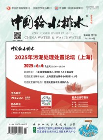
中国给水排水2025年污水处理厂提标改造(污水处理提质增效)高级研讨会
(第九届)邀请函暨征稿启事
同期召开中国给水排水2025年供水排水管网大会
(水环境综合治理)
同期召开中国给水排水2025年污水资源化利用
(再生水利用)大会/园区污水提标及资源化利用大会
(请提前报名回执,限1500人;本次会议仅限提前回执报名单位代表参会;参会代表可获得2025年年度继续教育学时证明;所有受邀演讲嘉宾均可获得加盖主办单位公章的会议演讲荣誉证书。)
时间:2025年3月8日—11日,3月8日报到,3月9日—10日会场报告,3月11日参观)
会场酒店:成都龙之梦大酒店
(地址:四川省成都市成华区嘉陵江路8号)
会议联系人:金晟 18622273726(微信同号),
技术报告咨询:王领全 13752275003(微信同号)
组织机构
主办单位
《中国给水排水》杂志社有限公司
中国市政工程华北设计研究总院有限公司
威乐(中国)水泵系统有限公司
协办单位
格兰富水泵(上海)有限公司
威海三田永磁科技有限公司
国家城市给水排水工程技术研究中心
天津创业环保集团股份有限公司
普拉克环保系统(北京)有限公司
国美(天津)水技术工程有限公司
威立雅水务工程(北京)有限公司
南京贝特环保通用设备制造有限公司
青岛欧仁环境科技有限公司
美国SDMC技术公司
上海管丽建设工程有限公司
天津倚通科技发展有限公司
中国石油大学(华东)化学化工学院
中国市政工程华北设计研究总院水务规划咨询研究院(北京分院)
中国市政工程华北设计研究总院有限公司智慧水务分公司
城市水资源开发利用(北方)国家工程研究中心
中国给水排水品牌委员会
国际水协会
中国水业网(www.water8848.com)
大会运作原则和目标:本届大会按照专业化、高规格、高水平的要求,突出“创新、协调、绿色、开放、共享”特色。
主办单位:
《中国给水排水》杂志社有限公司
中国市政工程华北设计研究总院有限公司
为推动供水排水管网高质量发展,提升供水排水管网管理效率,保障供水排水管网安全,推进新产品、新设备及新一代信息技术在供水排水管网管理中的应用,推进节水型社会和节水型城市建设,经研究,《中国给水排水》杂志社有限公司、中国市政工程华北设计研究总院有限公司定于2025年3月8日-11日在四川省成都市召开中国给水排水2024年供水排水管网大会。
参会和会务费
普通参会人员(设计院、水务公司、政府部门)为2300元/人(含会务、资料、场地、用餐、参观考察等费用),2025年1月18日前返回参会回执并汇款的普通参会人员为2000元/人;设备工程技术企业参会人员为2900元/人,2025年1月18日前返回参会回执并汇款的设备厂家参会人员为2600元/人。
注:需要现场或者提前领到发票的参会代表,请提前将会务费汇款到杂志社。会议费现场只能收现金,不能刷卡。
(收款单位:《中国给水排水》杂志社有限公司;开户行:建行天津河西支行;
账号:1200 1635 4000 5251 9625)。
组委会联系方式
王领全 13752275003(主办、协办、技术报告申请等)
金晟(发言 展位 发票和预订房等)18622273726
孙磊(广告、展示等)137 0211 3519
电话:022-27835639 27835592 13752275003
E-mail: 745105304@qq.com ; cnwater@vip.163.com
传真:022-27835592
邮编:300070
地址:天津市和平区新兴路52号都市花园大厦21层
2025年《中国给水排水》主办的主要会议(会议计划)
1、中国给水排水2025年污水处理厂提标改造(污水处理提质增效)高级研讨会(第九届)
同期召开供水排水管网大会(水环境综合治理)
同期召开污水资源化利用(再生水利用)大会/园区污水提标及资源化利用大会
时间:2025年3月8日—11日(3月8日报到,3月9日—10日会场报告,3月11日参观)
会场酒店:成都龙之梦大酒店(四川省成都市成华区嘉陵江路8号)
会议联系人:金晟 18622273726(微信同)
孙磊 13702113519(微信同)
技术报告咨询:王领全 13752275003(微信同)
2、《中国给水排水》第四届智慧建造×智慧水务 融合创新技术论坛
时间:待定
地点:待定
负责人:衣春敏 13920341911
3、第十四届雨洪管理与水环境(厂-网-河-湖)综 合治理研讨会
时间:待定
地点:待定
负责人:刘贵春 13752144199
4、《中国给水排水》第十二届饮用水安全保障技术(智慧水务)交流会
时间:待定
地点:待定
负责人:任莹莹 15122360102
5、2025年《中国给水排水》第十六届城镇污泥处 理处置技术与应用高级研讨会
同期举办:固废、工业污泥处理处置大会(城市+工业污泥协同处置)
垃圾渗滤液处理大会
高浓度难降解工业废水大会
时间:待定
地点:待定
负责人:金晟 18622273726(微信同) 孙磊 13702113519(微信同)
技术报告咨询:王领全 13752275003(微信同)
6、第二届《中国给水排水》绿色水务论坛
时间:待定
地点:待定
负责人:衣春敏 13920341911
7、《中国给水排水》杂志社第21届年会
《中国给水排水》青年编委会工作会议暨
第四届青年学者论坛
时间:待定
地点:待定
负责人:丁彩娟 13502042821(年会) 刘贵春 13752144199(论坛)